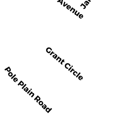
12 POLE PLAIN RD
Owner Information
LAVEZZO, EDWARD
12 POLE PLAIN RD
SHARON, MA 02067


Property Details
12 POLE PLAIN RD is classified as a Single Family Residential (Colonial).
The primary structure on this property was built in 1961. There are 3,045ft2 of built area within this property. There is 1,836ft2 of residential/living space within this property. This property is listed as having 9 rooms.
12 POLE PLAIN RD is valued at $497,400. The land is valued at $254,700 and the structures are valued at $242,700.
The most recent deed for 12 POLE PLAIN RD is recorded at the local registrar in Book 36198, Page 0288. 12 POLE PLAIN RD was last sold on Monday, August 6, 2018 for $360,000.
Assessment data from fiscal year 2022.
Flood Data
According to the FEMA National Flood Hazard Layer, this property does not appear to be in a flood zone. It may also be in an area not yet reviewed. Nonetheless, confirm this information prior to taking any action.
To view the flood hazards around this property, create a FEMA "Firmette" Map of the area around 12 POLE PLAIN RD.
Broadband Internet Providers
| Provider | Type | Bandwidth (mbps) | |
|---|---|---|---|
| GCI Communication Corp. | Satellite | 0 | 0 |
| Viasat Inc | Satellite | 100 | 3 |
| Verizon New England Inc. | DSL | 5 | 0 |
| Comcast | Cable | 1000 | 35 |
| VSAT Systems, LLC. | Satellite | 2 | 1 |
| HughesNet | Satellite | 25 | 3 |
| T-Mobile | Fixed Wireless | 25 | 3 |
Broadband service provider data from December 2020.
Adjacent Properties
- 10 POLE PLAIN RD
Single Family Residential owned by DEMETRIS S. PHOTOPOULOS & MARY PHOTOPOULOS TTEE OF THE DEMETRIS S. PHOTOPOULOS - 415 SOUTH MAIN ST
Two-Family Residential owned by GORBACHEV, DMITRIY - 14 POLE PLAIN RD
Single Family Residential owned by WAGED, FATIMA N - 429 SOUTH MAIN ST
Single Family Residential owned by WORLINE, KELSEY M.